
Updated Sept 26, 2025
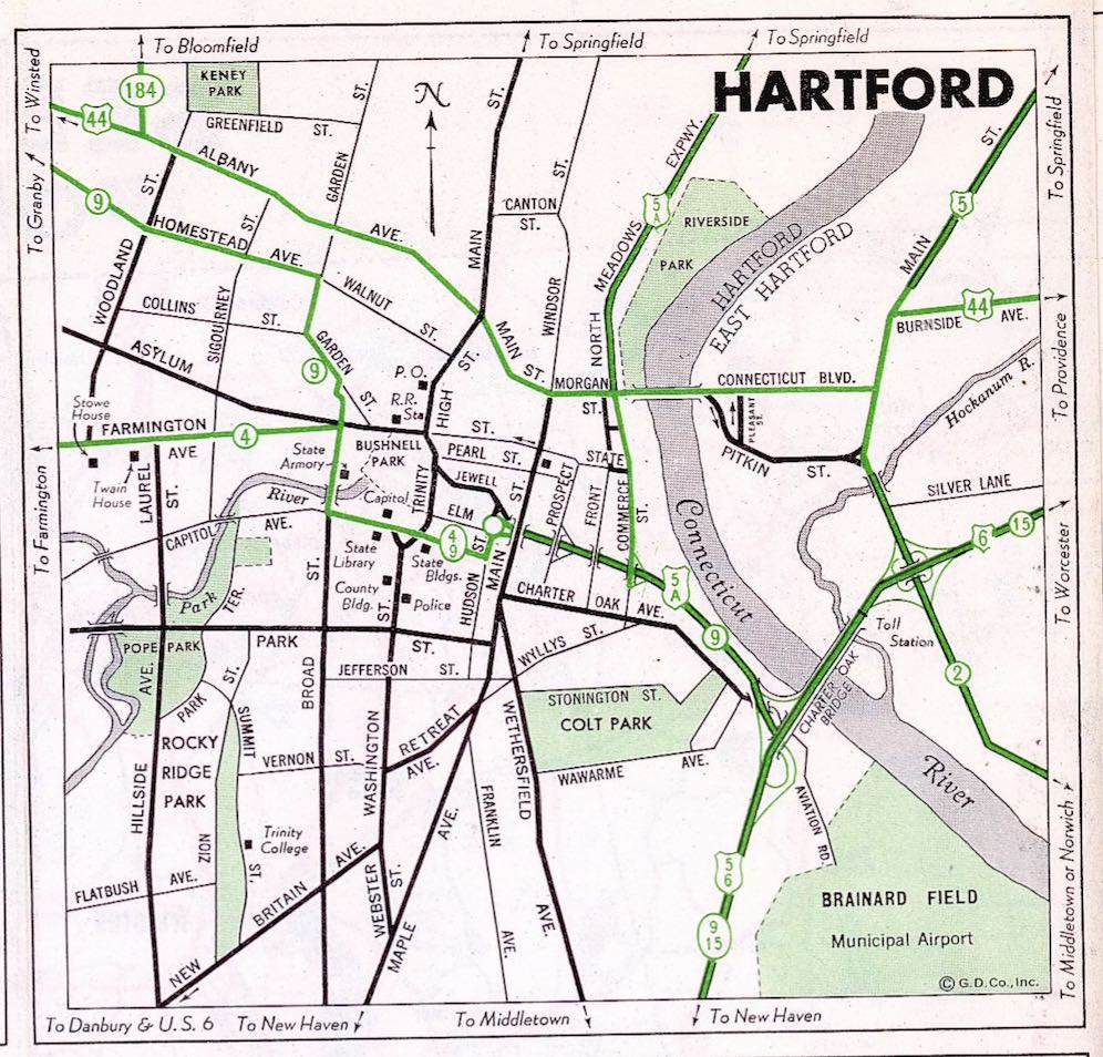
Picture yourself as a Hartford commuter in the early 1950s. The postwar economy is booming, the metro area is growing, and so is traffic. There are only 2 bridges in the area – the Bulkeley and the Charter Oak – and getting across the Connecticut River is a pain. You might spend an hour stuck in traffic. And you're not the only one complaining.
 In 1951, two bridges (the Bulkeley and Charter Oak) served all motor traffic across the Connecticut River between Middletown and Warehouse Point.
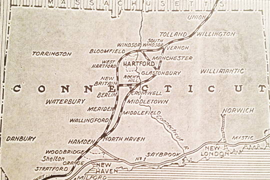
Long-range plans dating back to the 1930s had recommended a beltway around Hartford, with bridges at Rocky Hill and Windsor. Certainly those proposed bridges, with connecting thru highways, would relieve cross-state traffic in Hartford. I-291 was not yet a specific concept, but bypassing congested areas in general was well-known; the state had already built several smaller-scale bypasses along US 1 and US 5.
 State Highway Commissioner John MacDonald's $100M plan for extending the Merritt Highway included a beltway around Hartford, with new bridges at Windsor and Rocky Hill.
Throngs of motorists heading directly into Hartford, for work, shopping, or entertainment, also needed relief. In 1950, planners started discussing a new bridge connecting State Street in Hartford to the Meadows area in East Hartford – once a flood plain, but with recently constructed dikes, now developable land.
1955 plans for the upcoming Interstate Highway system included another bridge for Hartford. No numbers are marked, but in the map below you can see alignments for:
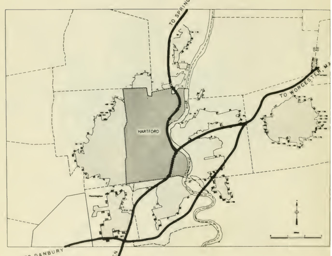 In 1955, two main highways (east-west and north-south) and one auxiliary highway were proposed for Hartford. No numbers were assigned yet. Document: General Location of National System of Interstate Highways, otherwise known as the "Yellow Book".
By 1958, the proposed alignment for I-84 was moved to the downtown Hartford location we see today, and the Putnam Bridge bypass, temporarily "E91" or "91-E", became I-491.
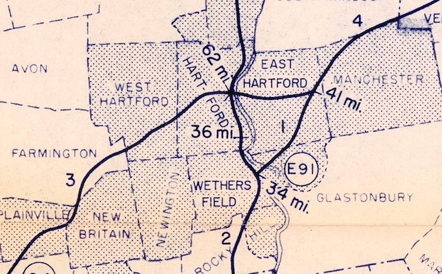 In early 1958, the numbering Wethersfield to East Hartford route was not yet finalized. On this planning map, the route is "E91"; a suggestion from the state as the time was "91E". By November 1958, the I-491 numbering had been selected.
In 1955, the state legislature created the Greater Hartford Bridge Authority, tasked with improving traffic flow across the river. On Oct 7, 1955, Gov. Abraham Ribicoff appointed a 9-member commission including as chairman a Hartford businessman named William H. Putnam. If the name sounds familiar, yes, the Putnam Bridge was named after him.
By 1956, the group had a plan to build up to 5 new bridges in the area. It would issue bonds, but its only source of income would be tolls – unpopular, but generally viewed as a necessary evil to help get the bridges built sooner. The proposed bridges, from north to south:
The Tower Avenue and Albany Avenue crossings were never built. I don't have much detail, but imagine they would both have been streets instead of freeways, serving local traffic.
The 3 new bridges opened in 1957 and 1958 as toll bridges; and on Jan. 1, 1958, tolls were also added to the Bulkeley Bridge. A group called the "Greater Hartford Free Bridge Association" filed suit against the Greater Hartford Bridge Authority in November 1958.
In Feb. 1959, Gov. Ribicoff announced a plan to have the state take over the 3 bridges built by the Greater Hartford Bridge Authority, including $38 million in bonds. On Oct. 1, 1959, arrangements had been completed to dissolve the Authority, and the Bulkeley and Founders bridge became toll-free.
The remaining bridges collected tolls into the 1980s: Putnam (1985), Charter Oak (1989), and Bissell (1985).
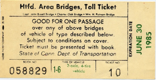 In the 1980s, a book of tickets (as shown), available for a small discount, was good for all three toll bridges in the Hartford area. However, you had to present the ticket book with your ticket – loose tickets were not accepted. Also note the expiration date.
The Greater Hartford Bridge Authority existed only four years, but ushered in three new bridges, including spans now used for I-291 and proposed for I-491. Chairman William H. Putnam passed away in 1958, and the Wethersfield - Glastonbury bridge, which opened Oct. 31 of that year, was named after him.
Although having the bridges in use is much better than the "no build" alternative, engineers and planners have learned a lot, and we have the benefit of hindsight. Unsatisfactory aspects of the highway system around Hartford include the following:
In the 1980s and 1990s, Riverfront Recapture led an effort to lower a section of I-91 and improve river access on both sides. A new effort called Hartford 400 hopes to transform the area even further, undoing past harms and making both cities more attractive and livable. Details of the plan, with maps include:
The cost of this would exceed $10 billion, and it's uncertain whether building parts of it (like the Route 2 bridge to I-91, while leaving everything else in place) would be worth the cost. But the proposal does include a new bridge, and a new vision for the area between the Bulkeley and Charter Oak bridges.