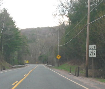
Approaching Route 219 on a lonely stretch of Route 20, on a cloudy day in Granby. Photo taken April 2004 by Kurumi.
Extended to Barkhamsted, then Granby
Route 219 was commissioned in 1935 along Town Hill Road in New Hartford, extending 4.63 miles from Route 4 (today's US 202) in the Nepaug section to US 44 at the village center. A portion of this road, from Burdick Road north, had already been under state maintenance as SR 711.
Aside from some realignment work, the portion of today's Route 219 from US 44 to Route 179 was actually part of Route 179; and the remainder leading to Route 20 was part of Route 181.
In 1941, Route 181 was relocated, as the planned Barkhamsted Reservoir would sever the route.
Reports of motorist confusion along Route 219 and Route 179, with some heavy vehicles ending up on steep grades, led the state to make some changes the following year.
On Jan. 24, 1944, routes 179 and 219 were redefined: Route 179 followed N. Canton Road toward US 44 in Canton, and Route 219 was extended along Reservoir Road and E. Hartland Road to Route 179, for a length of 11.17 miles.
On April 15, 1955, the state passed a bill to add 400 feet of Steele Road to the state system, completing state maintenance of Route 219 in the area. In 1956, engineers surveyed the Barkhamsted Road portion to make improvements. Near the town line at Hampstead Road, a portion of the highway was still unpaved.
In the fall of 1959, Gavitt Road and Barkhamsted Road (the old Route 181) were reconstructed and realigned. Route 219 was extended along these roads from Route 179 to Route 20.
Realigned in New Hartford after Flood
Route 219's original alignment in New Hartford, west to east, included Bridge Street and Cottage Street, with the Cottage Street Bridge, a steel span over the Farmington River. In August 1955, severe floods destroyed that bridge, along with dozens of others in Connecticut. Several months later, a temporary Bailey Bridge was erected in the same spot, with alternating one-way traffic controlled by a traffic signal.
In August 1956, design work started on a new bridge, to be located downstream of the old one, with a longer span, higher above the river. In August 1957, a public hearing was held regarding the proposed relocation of Route 219 in the area. The 1-mile realignment would accommodate the new bridge location, and provide smoother, safer curves. The new bridge and roadway opened to traffic on June 20, 1959.
Scenic designation requested from US 202 to US 44
In summer 1998, New Hartford's conservation commission applied for state scenic road status for six miles of Route 219, from US 202 to the Barkhamsted town line. This was turned down.
Small changes proposed
In the 1990s, the state was pursuing two changes to Route 219; the first was implemented, but I don't have confirmation of the second. The first project: fixing the intersection at Johnnycake Lane, a sharp, unsafe S curve. The second: minor widening along 2.7 miles, from the Farmington Turnpike to Route 318. Both projects spurred discussion from residents concerned that the rural charm of the route not be marred.

