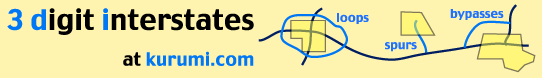
These icons (
Thanks to Garrett A. Wollman for this information, which would have been difficult for a non-Vermonter to deduce from a pile of maps.
I-189 Vermont (link)
1.49 miles [1![]() ]; connects I-89 and US 7 south of Burlington.
From Garrett Wollman:
]; connects I-89 and US 7 south of Burlington.
From Garrett Wollman:
"The original, pre-environmental-awareness plans for the highways around Burlington included a highway called the 'Southern Connector', which would connect downtown Burlington and the North End directly with I-89. The route of the highway would have followed the existing I-189 to Shelburne Rd. (US 7), cut around in a quarter-circle to Home Ave./Austin Dr., and then paralleled Pine Street into downtown. It would then have run elevated along the waterfront and connected to SR 127, the 'Burlington Beltline'.
"The full plan was cancelled in
the late 70s, when Burlington began to revitalize itself as a tourist destination
rather than a manufacturing city. Existing plans still call for the completion of
the highway as far as Battery St. downtown, but these plans were put on hold
~1989 to await the cleanup of the Pine Street Barge Canal toxic-waste site.
(There used to be coal gasification plants along Pine St. which would dump their
tar and other sludge into the canal. The current owners of the adjoining
properties are involved in legal wrangling with the city and state over who is
responsible for paying the cleanup bill.)" [2![]() ]
]
Southern Connector revived, but won't extend I-189
A new Southern Connector project is planned for around 2005, leading from
the end of I-189 at US 7 to Battery Street. This would be a parkway
(not a freeway, and not an interstate), and would terminate at a multimodal
transit station. [3![]() ]
]
See also:
- Interstate Guide: I-189 (AARoads)
I-289 (cancelled) Vermont (link)
Survives in spirit as VT 289, a four-mile two-lane limited-access highway (aka "Super 2") around Essex Junction; from VT 2A to VT 117. It opened in 1993. It's part of a planned Chittenden County Circumferential Highway, aka "The Circ."
From Garrett Wollman:
"I-289 was to be a similar eastern loop, from Williston (east of SR 2A) through Essex and Colchester to the Burlington line (at the other end of SR 127). In 1992 it was decided to forgo Federal Interstate funding to appease environmental concerns by only building a 'super two'. If I'm remembering my history right (I left in 1994), all of the road should have completed the design stage by now, and the section from US 2 to SR 117 was supposed to be the next one built.
Back in the days when highway planners were in their ascendancy, there were a
couple of other highways planned for Vermont as well, both of which left some
remnants for today. The (variously) 'Green Mountain Parkway' or 'Ethan Allen
Expressway' would have followed US 7 from Bennington to Burlington. Another
highway would have followed US 4 from Glens Falls, N.Y. to I-89 and I-91 at White
River Junction. Some wag also proposed (I don't know whether it was serious or
not) an expressway linking the state's major ski areas along the SR 100 corridor."
[2![]() ]
]
Mike Moroney reports that one VDOT engineer said VT 289 was never intended
to be I-289; but qualifies it: "Not sure I believe him." [3![]() ]
]
See also: StopTheCirc.com, opposed to VT 289; has good background info and maps
Sources
- Route Log and Finder List - Interstate Highways, FHWA, Oct. 31, 2002.
- Wollman, Garrett. "Re: New Web Site: 3-digit interstates; all CT highways." Email to kurumi, Jan. 17, 1997.
- Moroney, Mike. "Re: A few Vermont questions." Online posting, misc.transport.road, Dec. 16, 2002.